
Drone inspection
As one of our services, we can help you with carrying out inspection, mapping, photo registration and measurement with drones throughout the country.
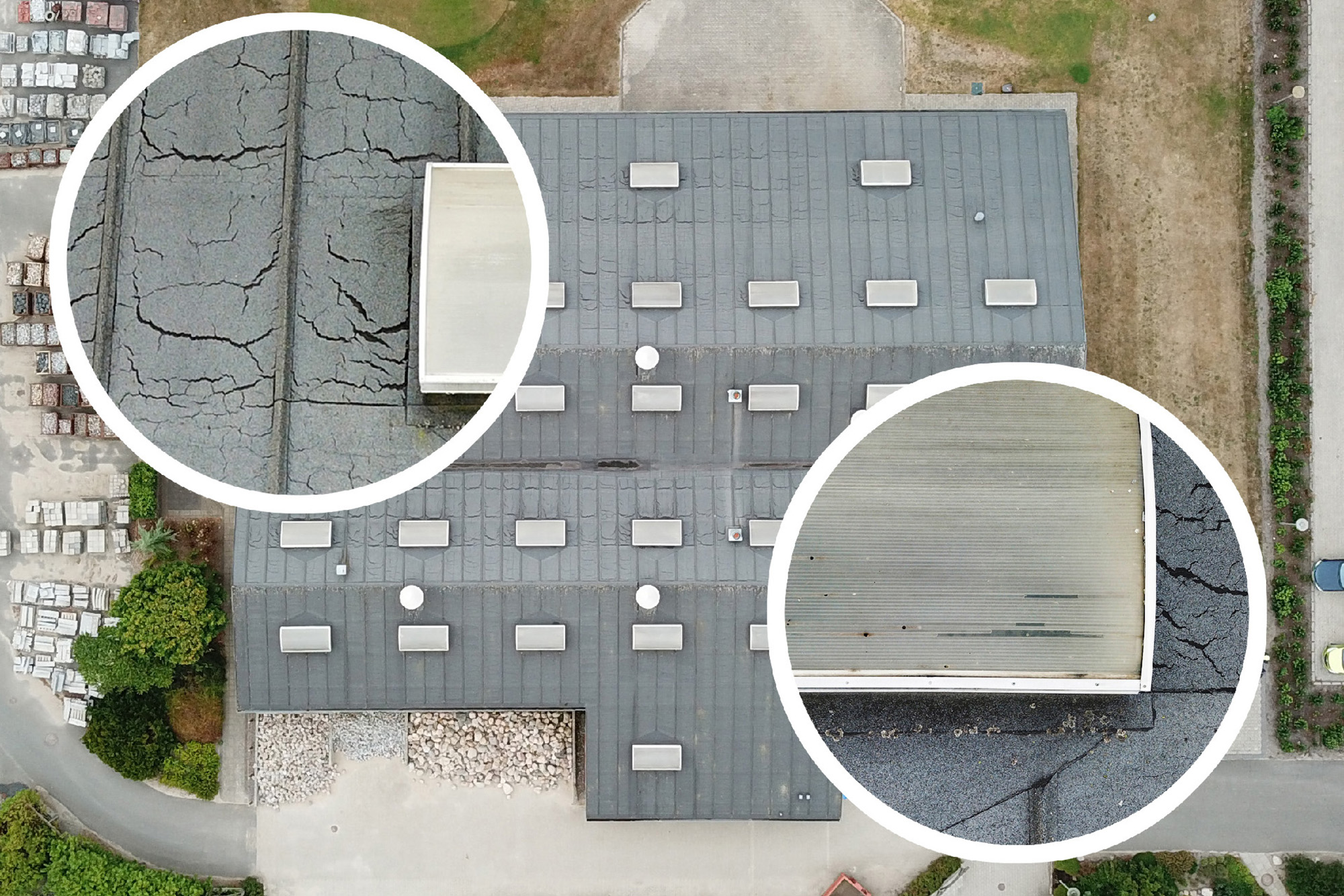
With data from regularly performed aerial mapping, it is possible to make a project's progress visible, and to ensure and expand efficiency and quality. It ensures you a consistent data set by flying according to fixed coordinates, where we take the same pictures with the same angle from the same height every time. Subsequently, you receive your data in the form of point clouds, 3D models and raw photos, and get up close to the details, both exterior and interior of buildings and constructions. With the use of drones, we can make it possible to inspect places that are difficult to access or unsuitable for normal traffic.
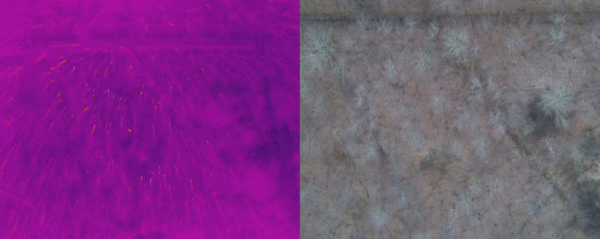
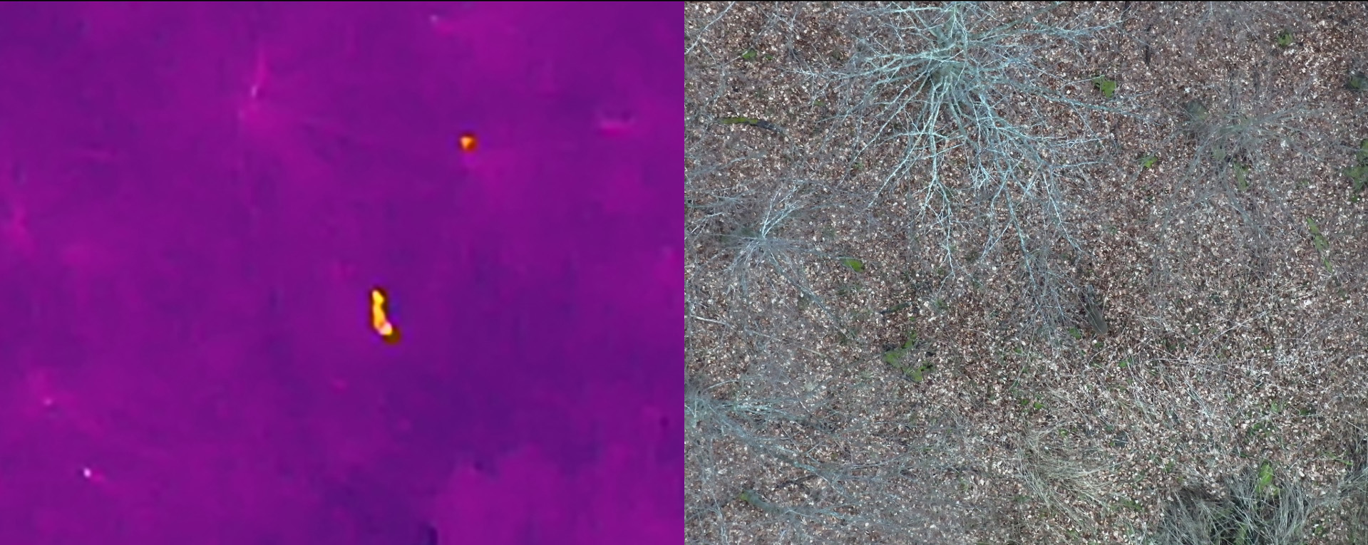
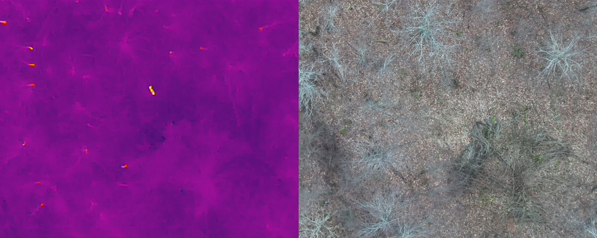
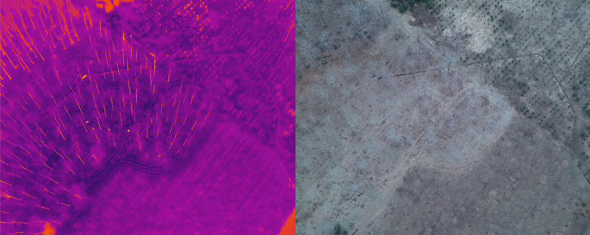
The more knowledge you have about your project, the better decisions you can make. By using modern drone data collection, it is now possible to get completely new information about the condition of your construction site. With advanced software, you get the opportunity to make elevation calculations for leveling, volume calculation of all types of "piles" on the construction site. Distance and area measurement in precise 2 or 3D models, which are easily accessed from a computer or tablet. Electrical installations with overloads and broken supply lines also cannot remain hidden from our drones with heat-seeking cameras. Solar cells are exposed in all kinds of weather, with our drones we can see if they are in good condition and working optimally.
With us as a partner, you will benefit from resources resulting from more than 14 years of experience in drone technology, inspection and legislation, and 30+ years of experience in conventional inspection, measurement, analysis and consulting. Save time and resources on training your own personnel, planning and permits, and on the purchase of equipment and software for data processing. Our drone technical department has a background such as product developer, operator and legal consultant.
In collaboration with our drone manager, have a plan drawn up that fits your projects specifically, based on the data you want, for example:
- Orthophoto
- Thermography
- 4K video
- Point cloud
- 3D model
- Terrain model
- Volume calculation
- Area measurement
Get a drone inspection quote from In-Situ Consult