
3D Scans, AutoCAD and Floor Plans
With digital twins, you can have the opportunity to take a virtual tour of your property. This allows you to present properties to customers, potential buyers, make virtual inspections, measure directly in the model and get a floor plan of the property and much more. The technology makes it possible to sit in several places in the country and review a digital drawing, without having to worry about travel time and expenses etc.
Once the actual scan is done and data is collected, it opens up many options for post-processing. Our platform automatically stitches all your data together and lets you easily export your data to other platforms, saving you significant amounts of manual work and time.
Depending on how precisely the model is desired and what it will be used for, you can either scan with a laser (high precision 99.9%) or an infrared 3D sensor (99% precision). Laser scanning is generally more detailed due to the higher collection of data points, but also takes longer per scan. On the other hand, you can cover a much larger area than the 3D Scanner
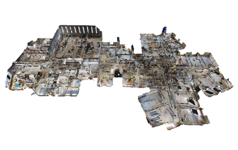
With the 3D sensor, you can scan approx. 250-300 sqm in 1 hour with approx. 30 sec. Per scan. The model provides access to virtually inspect the scanned item, and subsequently transform the model into a "clean" point cloud, an AutoCAD/Revit model, a floor plan, etc.
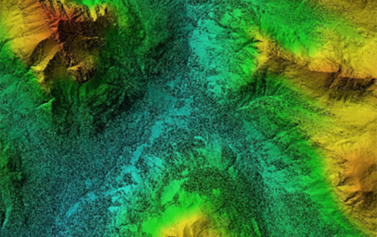
With our underwater drone, we have the opportunity to scan on land, at water and in the air, as well as combine these to give a full overview.
With the underwater drone, you can also scan sheet pile thicknesses, register debris on the bottom, etc.
Get an offer for 3D Scans, AutoCAD and Floor Plans at In-Situ Consult